


Plan the Site

We first take initial plans and mark all the areas which need to be scanned and create a schedule of scan and the pathway for the scanning activity, this process helps us in planning the scanning activity efficiently and capturing maximum information during the site survey. The number of scan points depends upon the clear sight of view, if there are more partitions or obstructions generally the number of scan points will increase, also in some of the spaces where ceilings must be removed to capture the above-ceiling services.
Scan the Area
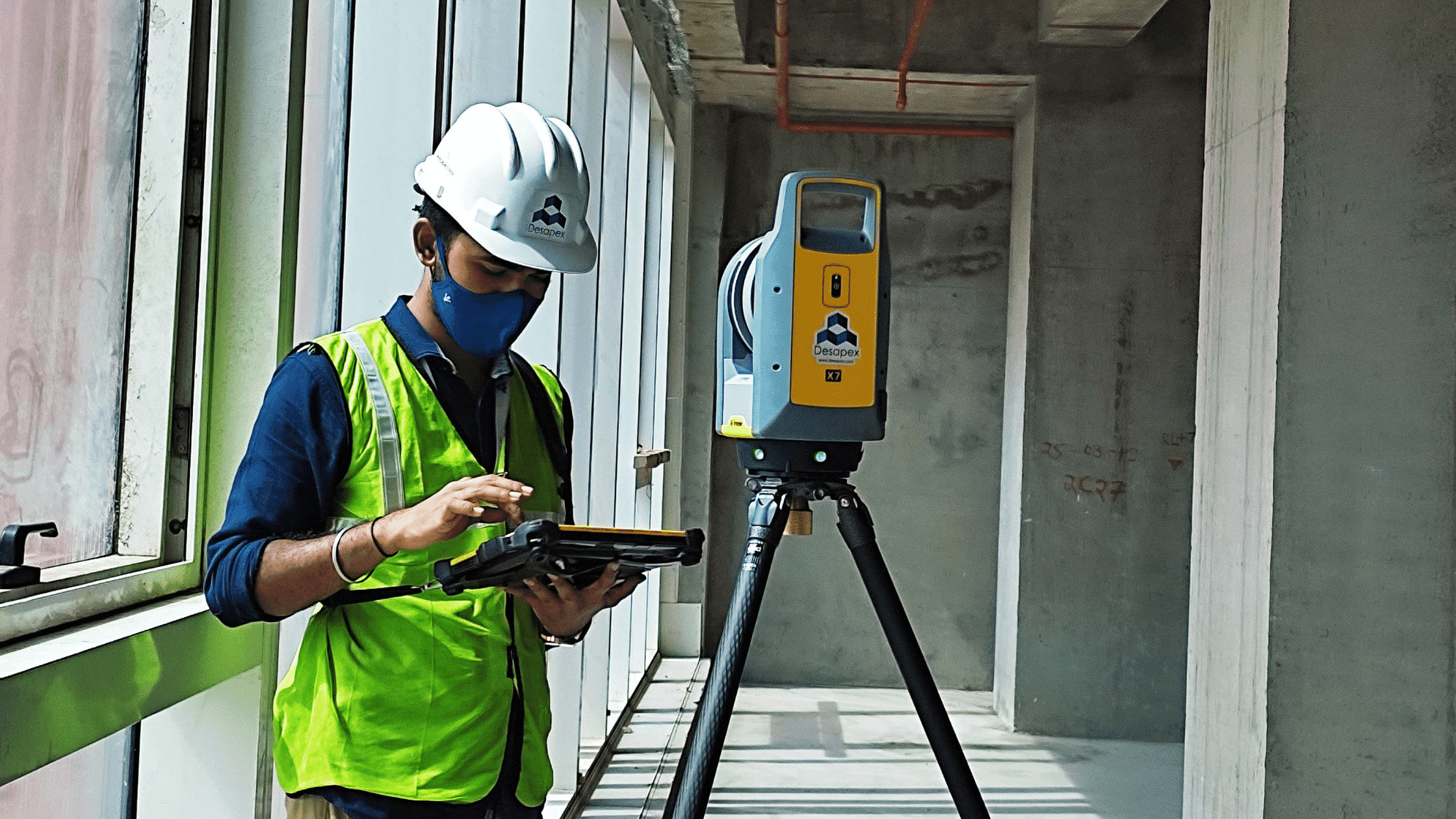
After the planning, our team of site surveyors will visit the factory to scan to the factory layout during this process, our team will be carrying the TLS units along with manual measurement and georeferencing devices to scan and calibrate the data, the schedule of the scanning depends on the size and sight of clear view in the area, if there are more obstructions, naturally the number of scans will increase. Generally, a typical medium-level scan will take 4 minutes to scan the given location with mm accuracy.
Processing the Data
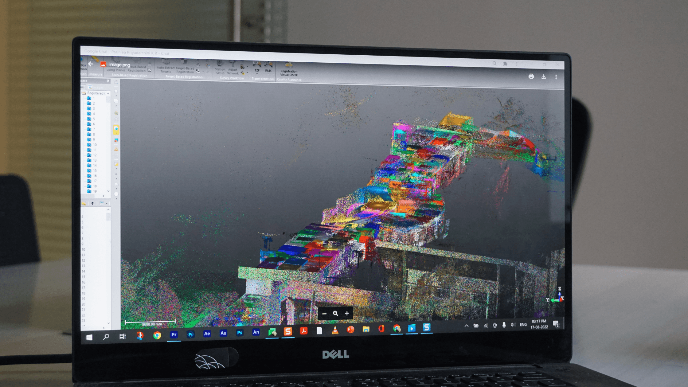
The point clouds generated by each scanning position are merged and transferred in the same coordinate system, using specialized software tools, in a process that is called Point Cloud Registration. After removing the unnecessary points of the surrounding of the building, the point cloud is ready for use by the client, or for further processing to produce the 3D BIM Models. So, for example, a building or particular facility might have a1000 of scan points but, during this step, we will merge all the data and create it into one building or one area file which can be easily linked into modeling tools.
BIM Modelling
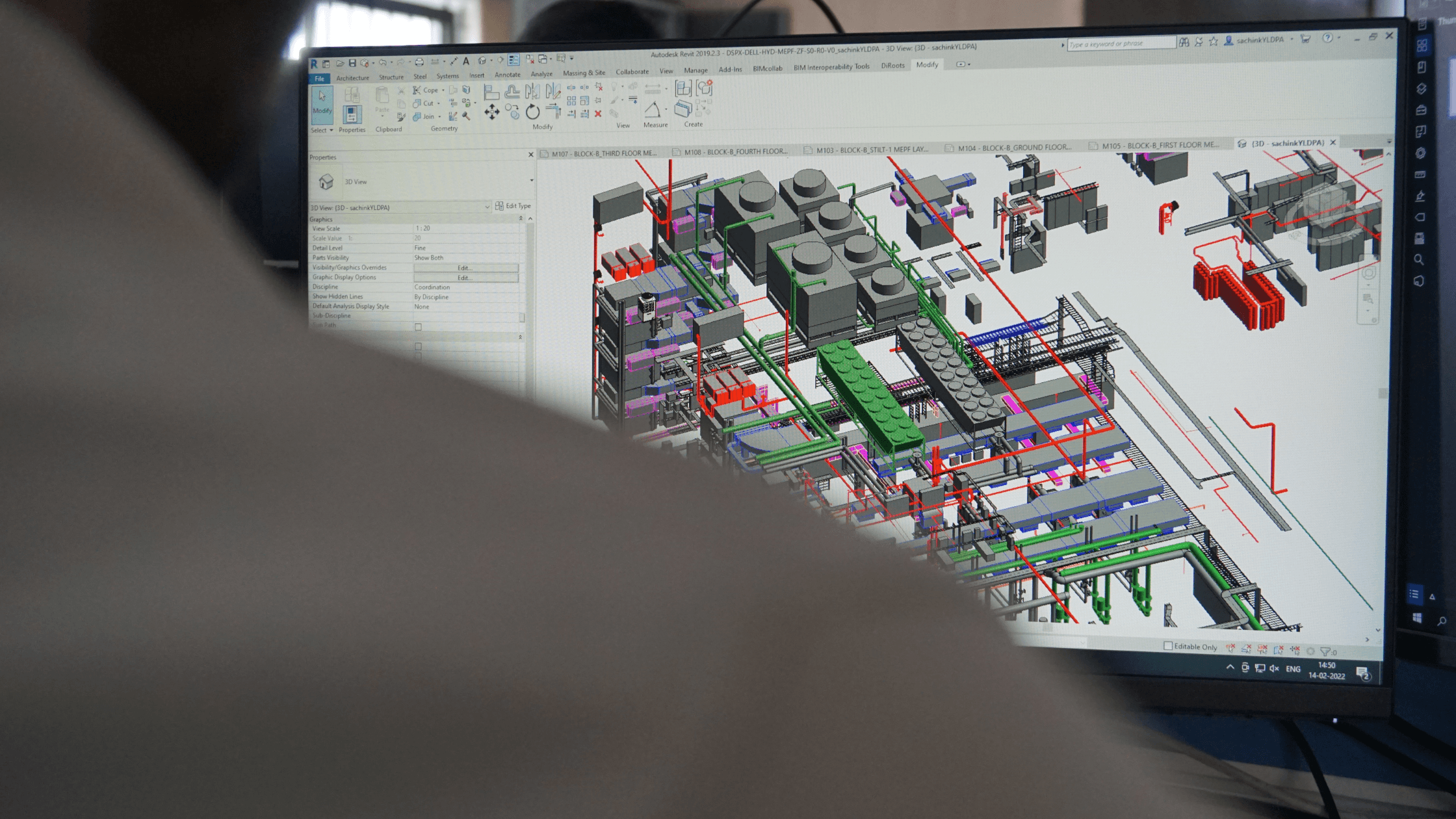
Once we are done with the processing, we publish the data into a cloud server where our clients can perform their virtual site navigation and track the construction progress or use the BIM model documentation as as-built, in this step, we link the point cloud data to model all the elements and classify the point cloud data into BIM Model elements. This process includes the use of semiautomatic plugins which understands the surface data and identifies the point cloud into specific objects, but also some manual interventions to add the exact data related to building geometrics and non-geometric data, this becomes the data library of the building with object linked into it.