


What is Scan to BIM?
Scan to BIM is a process of capturing your Built environment and converting it into a digital model which can be used for planning, monitoring, or managing the built environment, it enhances the proper coordination with stakeholders in sharing the project information.
In the present era, there is n number of facilities that were constructed 50 years and 80 years back, there was no digitalization. In the modern era, we have digital technology to capture data. where we can bring your physical building into a digital Building which helps in pulling out of Geometric and nongeometrical information of your existing building where we create a replica of your physical building into a digital 3d model.
We have the in-house capability for doing laser surveys and converting into a Digital model of your building, where you can take a virtual tour/ walkthrough inside the facility and which allows you to get all the geometrical and Non-geometrical information and asset information that are available in your facility.
Benefits of Scan to BIM
1. Scan to BIM process allows you to get an errors free Model which helps you to get the errors free construction.
2. Scan to BIM process gives you one collaborative platform to increase the efficiency of the design and construction process to make it smoother and faster in the AEC Industry.
3. Scan to BIM process helps you in highly accurate and appropriate data of your facility which will be used for future retrofitting, renovation, and space management projects.
4. Scan to BIM enhances the proper coordination with all the stakeholders and also it saves time in the decision-making process on your project.
5. Scan to BIM helps us to find out the collaborative issues like detecting the clashes at the design stage and helps you to get the clash-free construction.
How is Scan to BIM useful in all the stages of construction?
Design
In the design stages, it helps Documenting the present facility gives an understanding on the geometric of the buildings or the site conditions and this will be the base to work on the design for any Interior fit outs and renovation projects. Scanning also helps to get the accurate site conditions, boundaries and the ground profile for planning green field projects.
Construction
Construction with BIM it is possible to identify any type of discrepancy between the As-built and the BIM model.
Operation
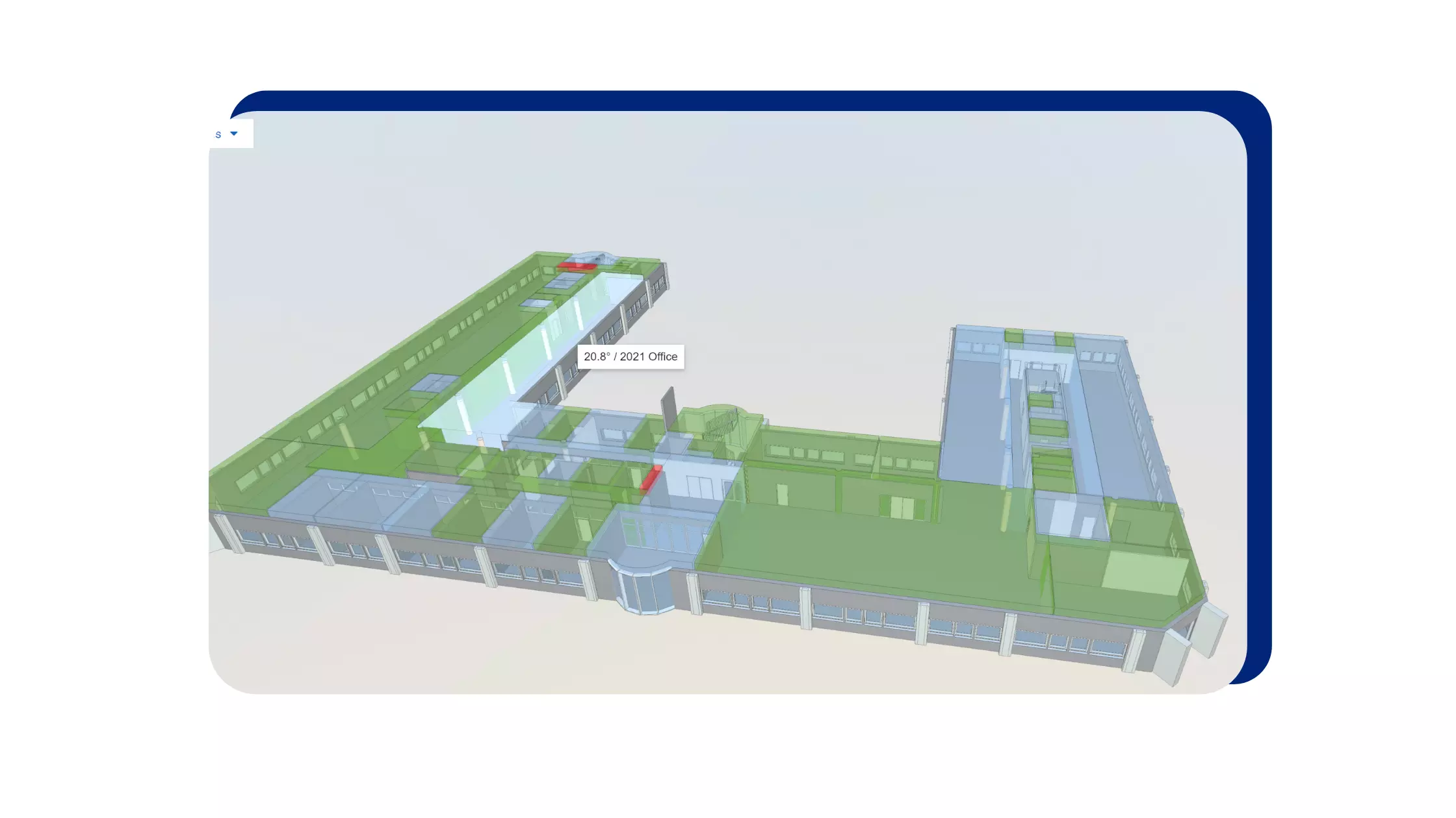
BIM Model helps with 3D visualization and gathering the building information from the BIM Model. When you have a digital twin model, Facility management functionality can be improved, such as space management & Planning, renovation planning and execution, emergency management, and staff training and development.
What is the process of Scan to BIM?
Plan the site
This is a preliminary step of scanning the site. First, we need to plan the area of the site which needs to be scanned and schedule the plan accordingly. It is a process that helps us in planning the scanning activity efficiently and capturing maximum information during the site survey. We are placing our scanners in multiple locations to capture the data. If there are more partitions or obstructions, above the ceiling that need to be scanned then our number of scanner placing locations may vary.
Scan the area
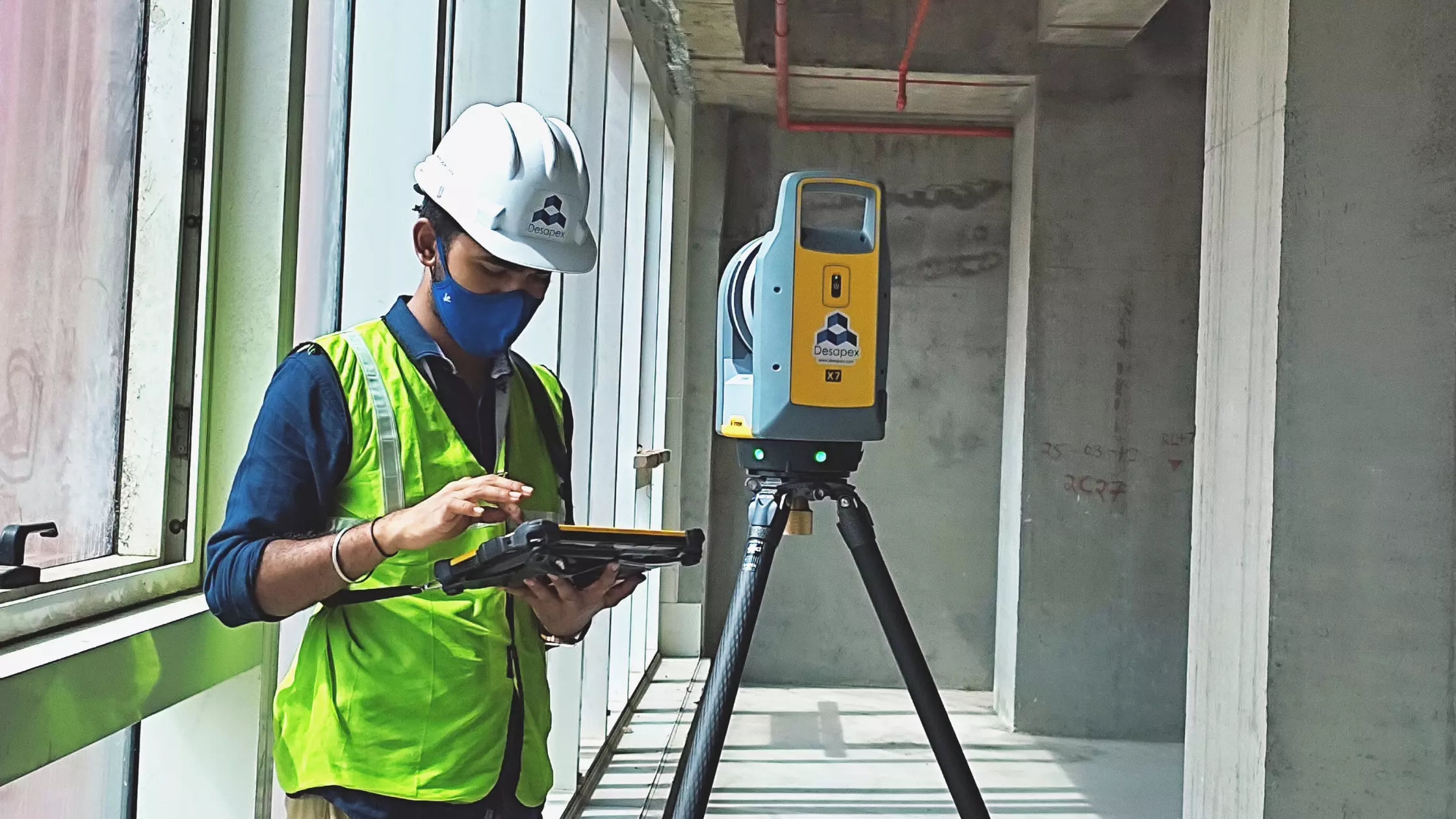
After planning our surveyor team will visit the site to scan the factory layout during this process our teams will be carrying the TLS units along with manual measurement and georeferencing devices to scan and calibrate the data, the schedule of the scanning depends on the size and sight of clear view in the area, If there are more obstructions naturally the number of scans will increase. Generally, a typical medium-level scan will take 4 minutes to scan the given locations with mm accuracy.
Processing the data
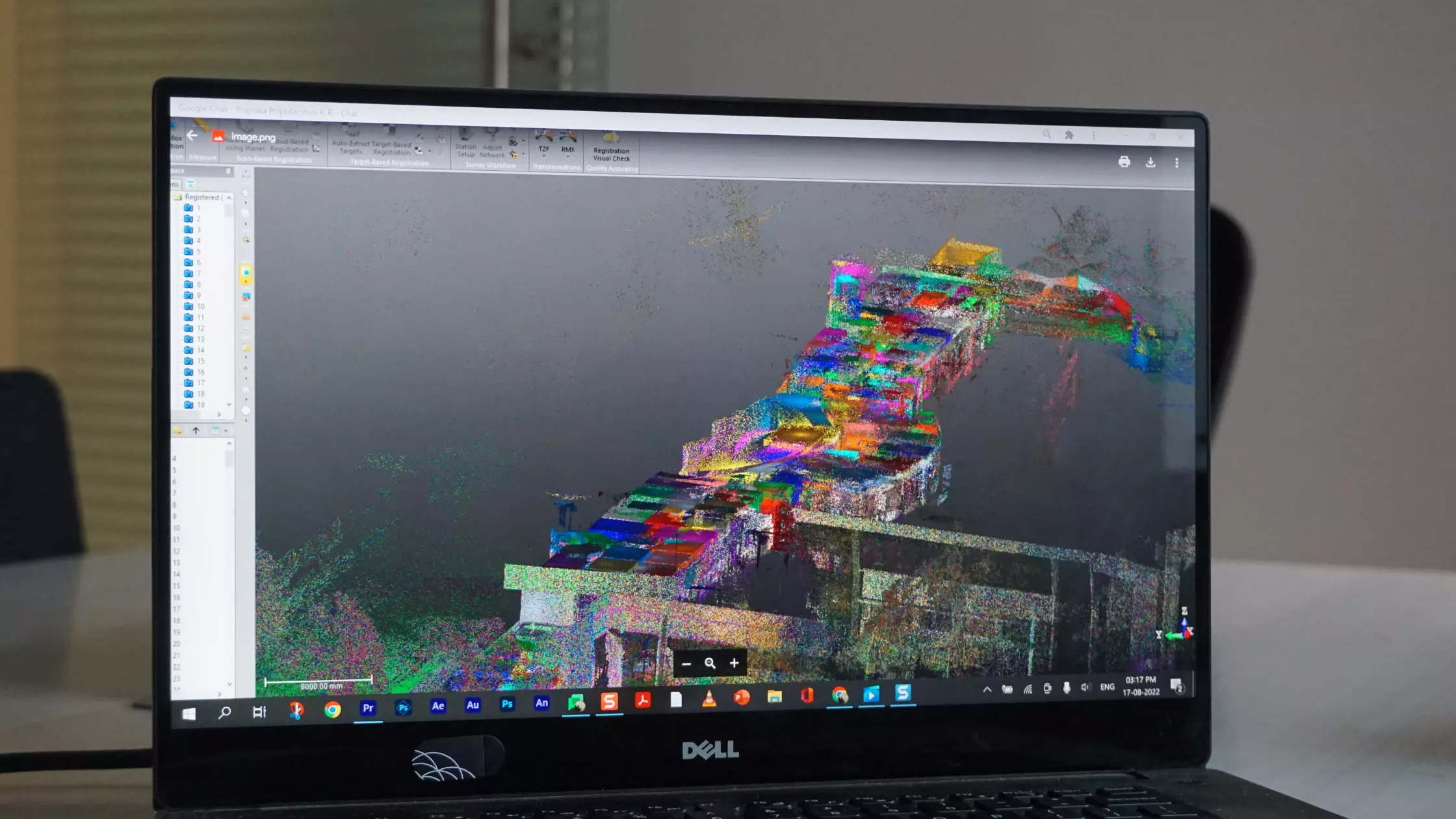
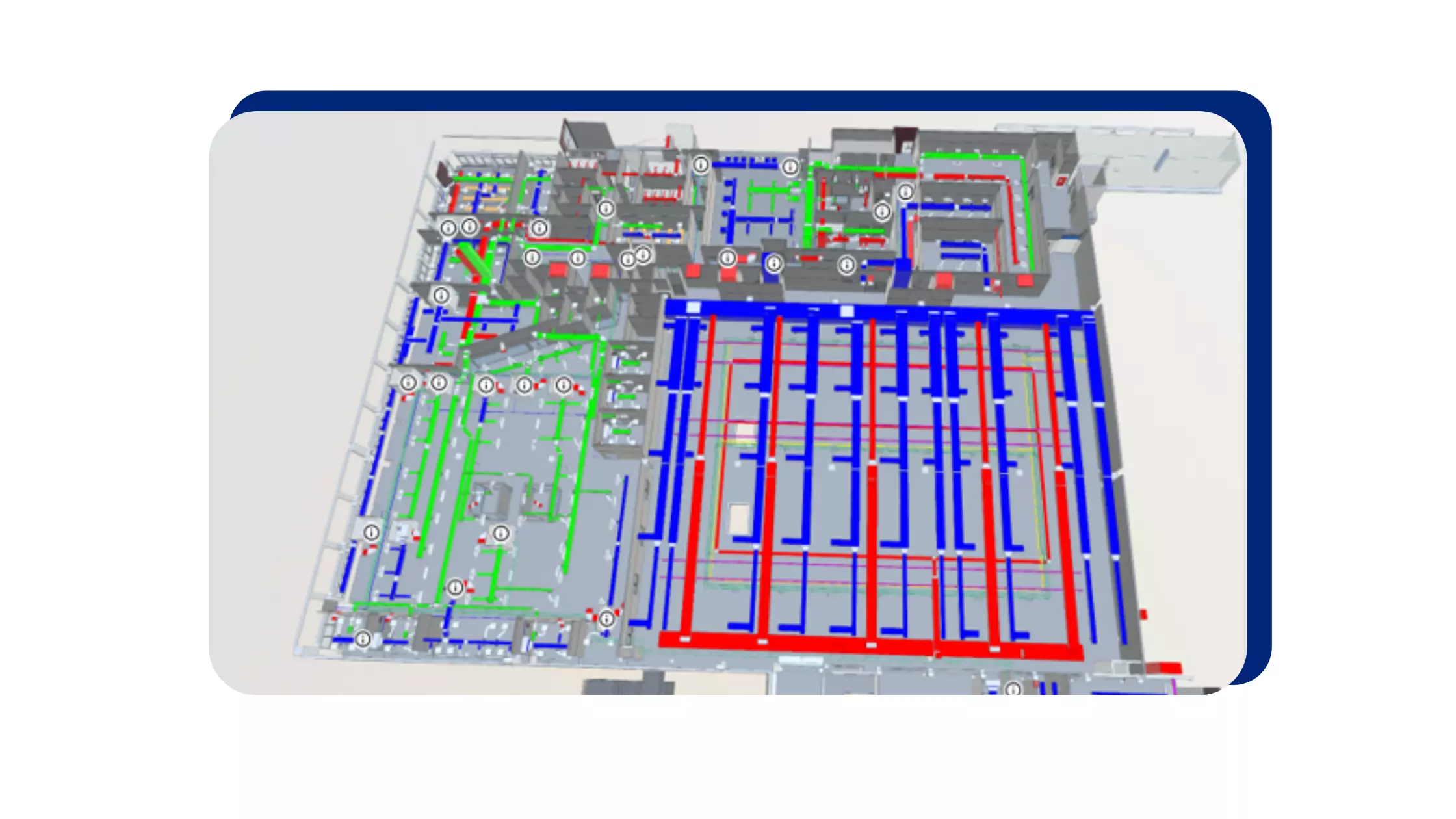
The points clouds which have been generated from each scanning position are merged and transferred in the same coordinate system by using specialized software tools, in a process that is called point cloud Registration. After validating the point cloud is ready to use from the client or for further processing to produce the 3D BIM Model we need to merge all the data and create it to one building or one area file which can be easily linked into the modeling tools
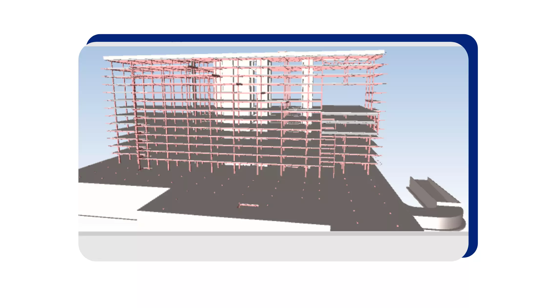
BIM Modelling
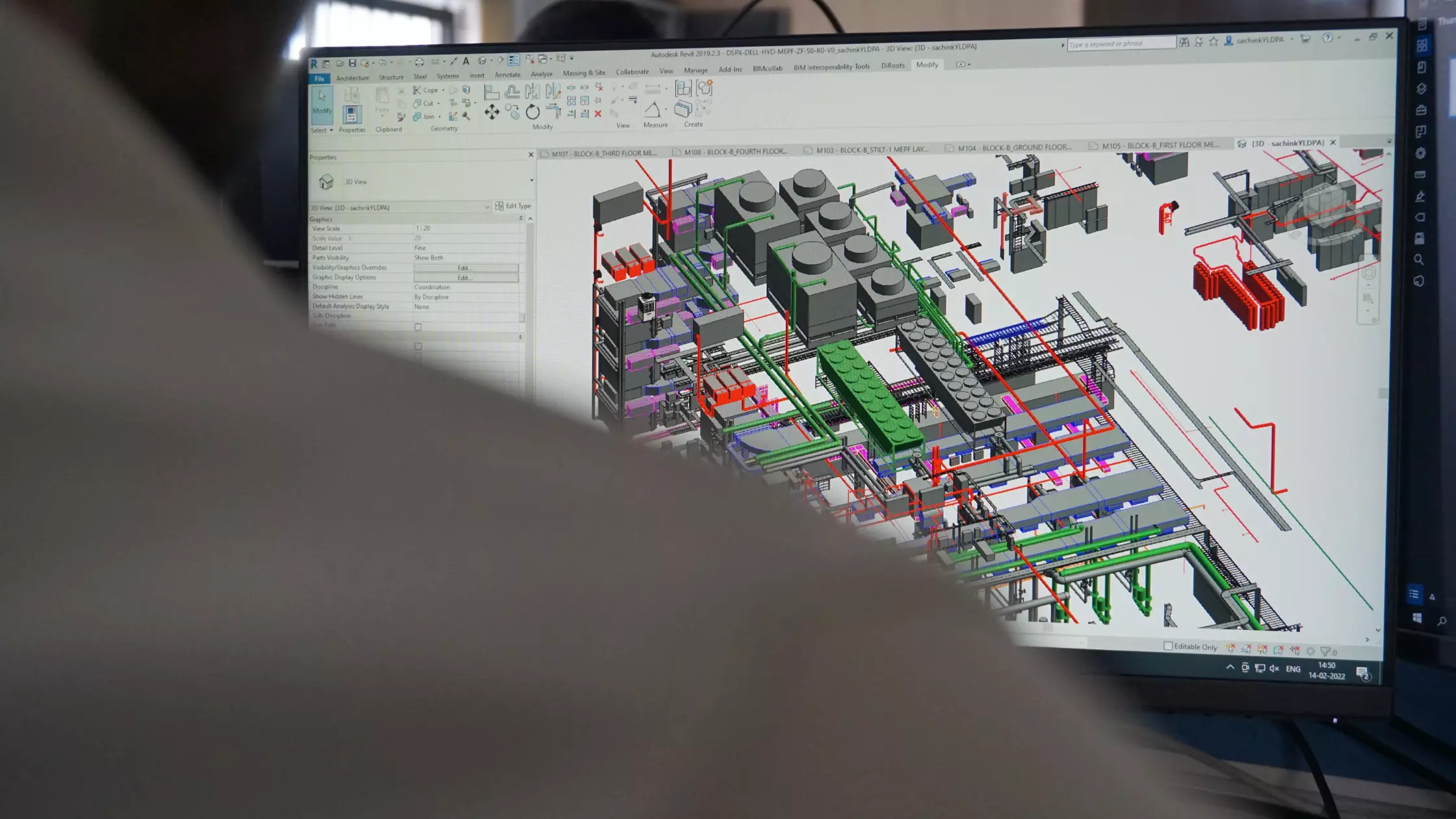
Once we have done with the processing we publish the data into a cloud server where our clients can perform their virtual site navigation and track the construction progress or use the BIM Model documentation as built, in this step we link the point cloud data to model all the elements and classify the point cloud data into BIM Model elements, this process includes the use of semiautomatic plugins which understand the surface data and identifies the point cloud into specific objects, but also some manual interventions to add the exact data related to building geometric data and nongeometric data this becomes the data library of the building with object linked into it.
Globally Desapex is the first company and the only company in India to have BSI Kitemark for BIM
We provide service across the complete lifecycle of the project from the pre-construction stage to the operation stage
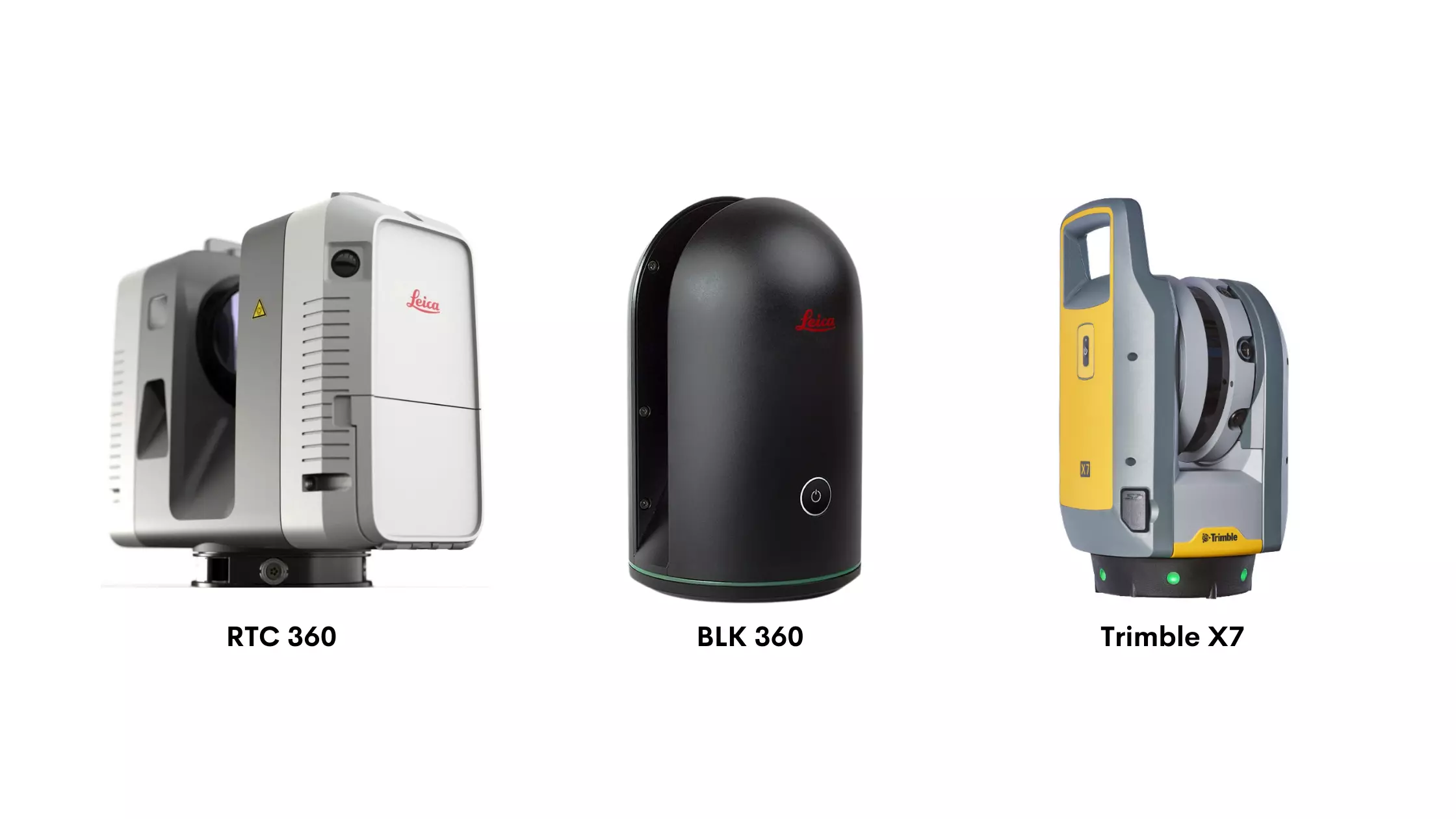
The type of scanners we use are:
1. RTC 360
2. BLK 360
3. Trimble X7
All our Scanners have a typical range of 0.5 to 130 meters, with a field view of
360 deg horizontal and 300 deg vertical. Laser scanners emit laser beams to capture elements around it.
The Scanners we use are of Class 1 rated in accordance with IEC 60825-1:2014
standard and Class 1-rated laser scanners are totally safe to work around without any additional safety equipment requirements. Exposure to laser light is not harmful to human beings. Scanners have high sensitivity time of flight EDM, electronic Distance measurement technology to effectively capture dark and reflective surfaces.
This will allow us to capture high-resolution images even in dark environments like the basement and shafts.
We have an experienced resource who can capture the existing condition using terrestrial laser scanners. We have done 1 million sq ft scanning by our in-house team where they process the captured data by keeping multiple scan stations and delivering into single point cloud data.
We have in-house Architects & MEPF modelers to develop the model and generate the required floor plans, and sectional views from the point cloud data.
We have in-house capabilities of scanning and modeling. Feel free to reach us if you have any above-mentioned requirements at sales@desapex.com